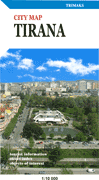
Publisher: Trimax
Year of publication: 2016
Dimensions: 96 x 66 cm
Size: 1: 10 000
Production: Printed on congrup 115g / m2. Lacquered, packed in a bag.
ISBN: 9989-940-82-7
The map is a detailed overview of the city with all its streets, starting from the boulevards, the main streets to the earthen paths. With special color are marked inhabited, uninhabited and industrial zone, forests, parks, and marked all buildings and public buildings. Symbols show the embassies in the city, hospitals, ambulances, police stations, railroads, museums, theaters, cinemas, schools, faculties, post banks, markets, churches, mosques … On the map, on the other side index, where alphabetically the streets are arranged, which facilitates their request through the map. Here is also a map of Albania, with the larger towns along with the road and railway network. It is designed for easier navigation in daily traffic throughout Tirana, as well as specialized needs of taxi services, service providers, funders, public services, students, students, etc.