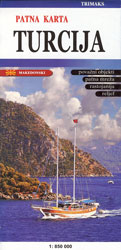
Publisher: Trimaks
Year of publication: 2017
Dimensions: 96X66 cm
Size: 1: 850 000
Production: Printed konzdruk of 115 g / m2. Lacquered. Packed in a plastic bag.
ISBN: 998994040-8
On the road map Turkey is represented the whole road and railway network, starting from highways, highway, regional to local roads, which can lead you to any desired destination. The distance from one place to another is marked with numbers, and with all the major symbols and toponyms almost all major settlements, mountains, rivers, lakes, seas, islands, bays are marked … With small symbols are marked the airports, baths, monasteries , ports, ski resorts, hiking trails, national parks, reserves, and more important maritime roads are given … The map contains an index, which makes it easier to search the required place across the map. On the map, on the other side, there are more important figures for Turkey, such as the number of people, religion, languages spoken, and a small section of the Kusadasi center, with the larger streets and its landmarks, is given.


